
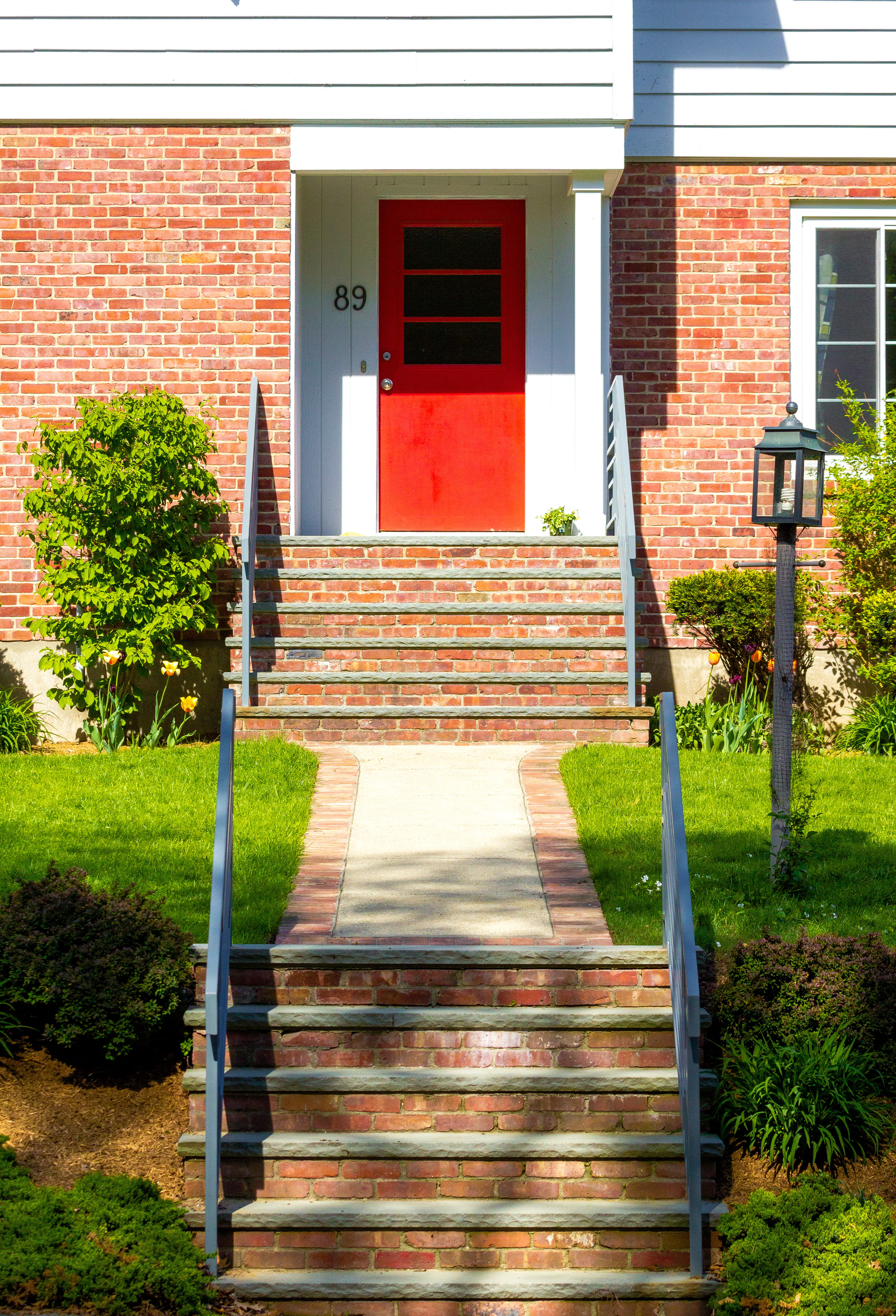
The front entry of the Ephraim Cutter house on Water Street. April 15, 2012.
The front entry of the Ephraim Cutter house on Water Street. April 15, 2012.

The front entrance of Sunrise of Arlington, a senior living community, decorated for the holidays.
December 14, 2015.

The entrance to D’Agostino’s Delicatessen on Massachusetts Avenue in Arlington Heights.
December 14, 2015.

The front door to a home on Teel Street.
June 20, 2014.

The front door of a home requests the no solicitors call.
September 11, 2013.

A house on Summer Street doing its best to match the sky.
September 11, 2013.

The steps and accessibility ramp of the Trinity Baptist Church in East Arlington.
June 20, 2014.
A red door on a Ridge Street home.
May 12, 2014.
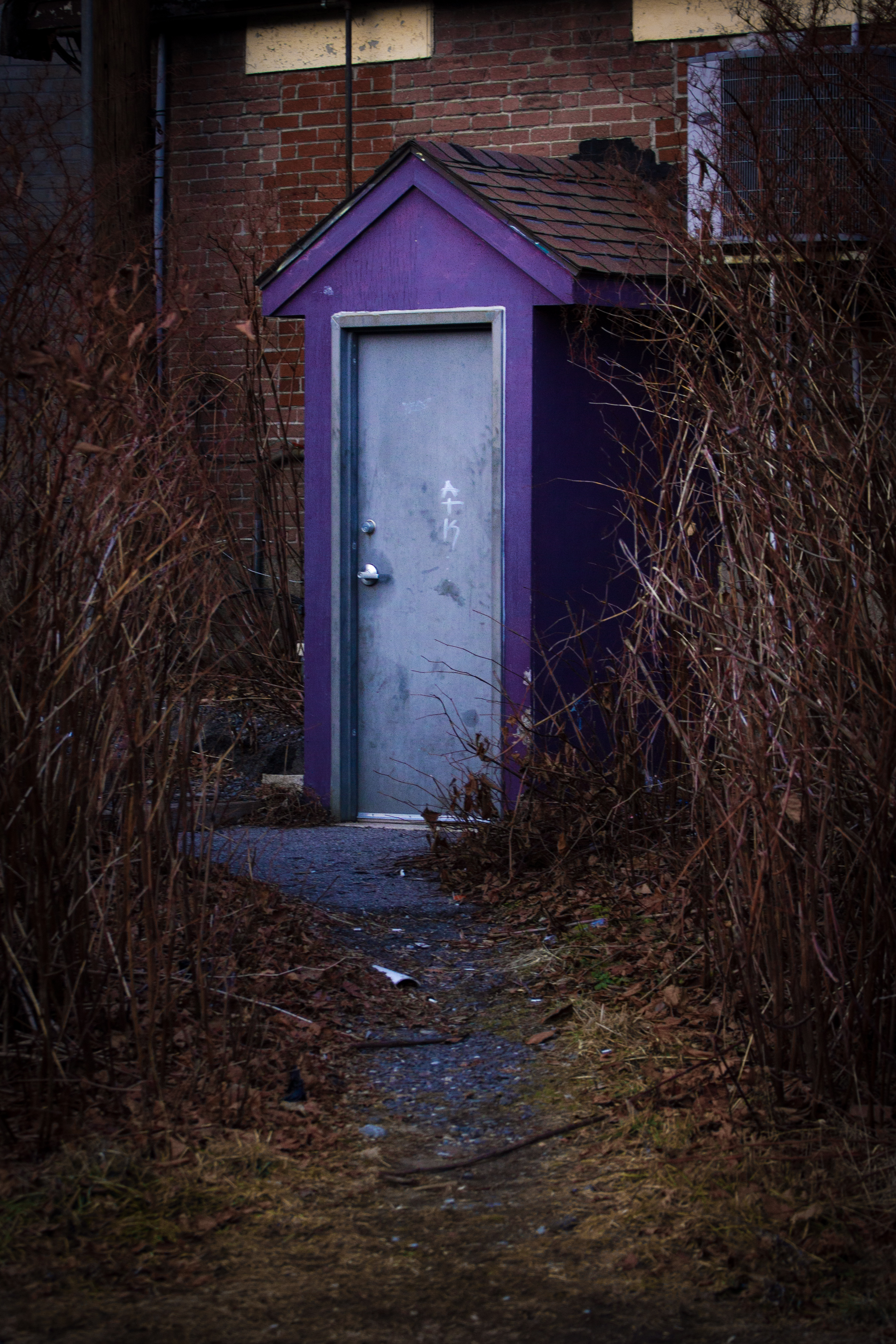
A short path off the Minuteman Bikeway leads to the back door of Scutra Restaurant on Summer Street.
January 13, 2014.
A house decorated for Halloween on Crosby Street.
October 3, 2013.

Scaffolding on a home on Teresa Circle.
October 22, 2012.
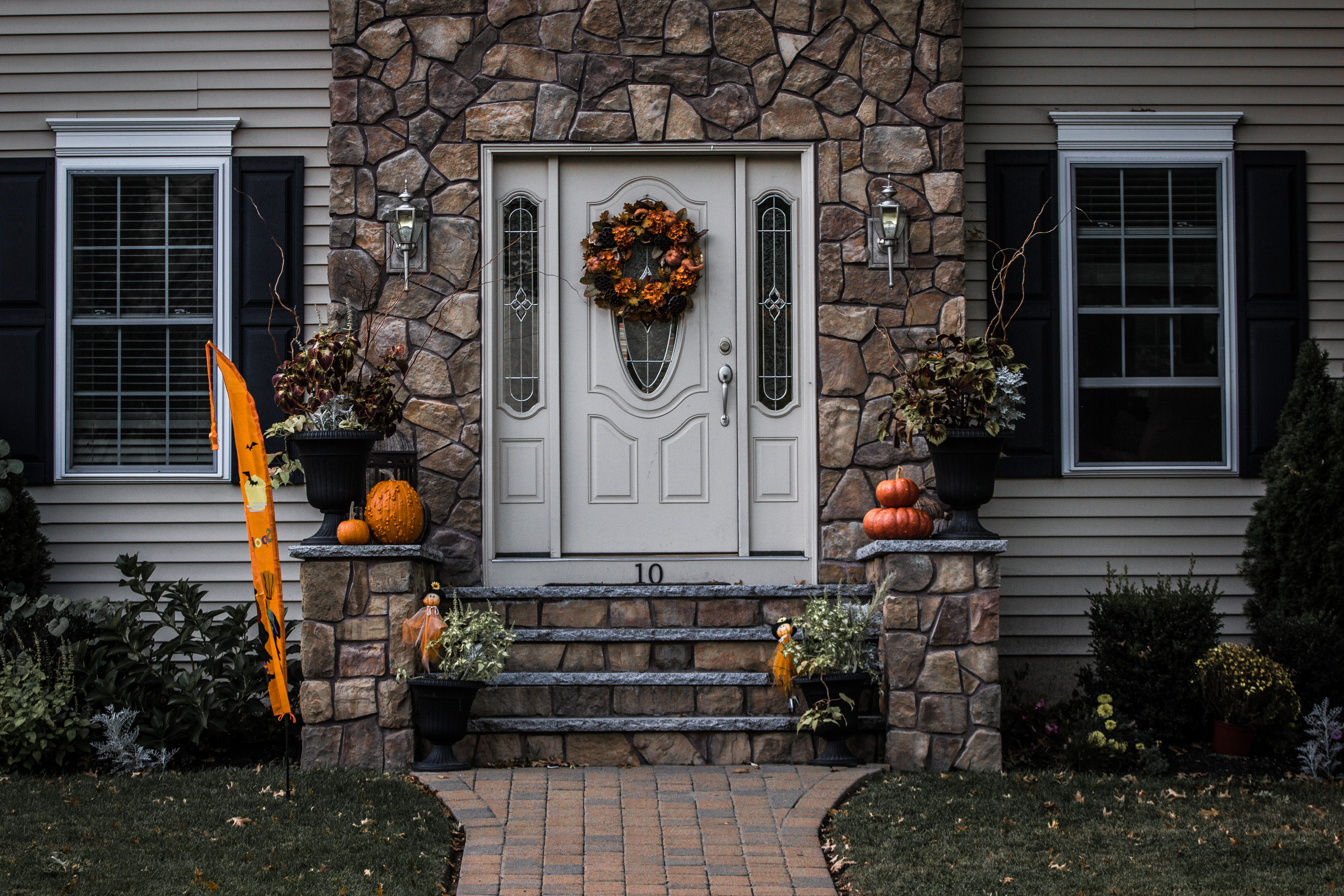
A home on Washington Street decorated for the fall.
October 22, 2012.
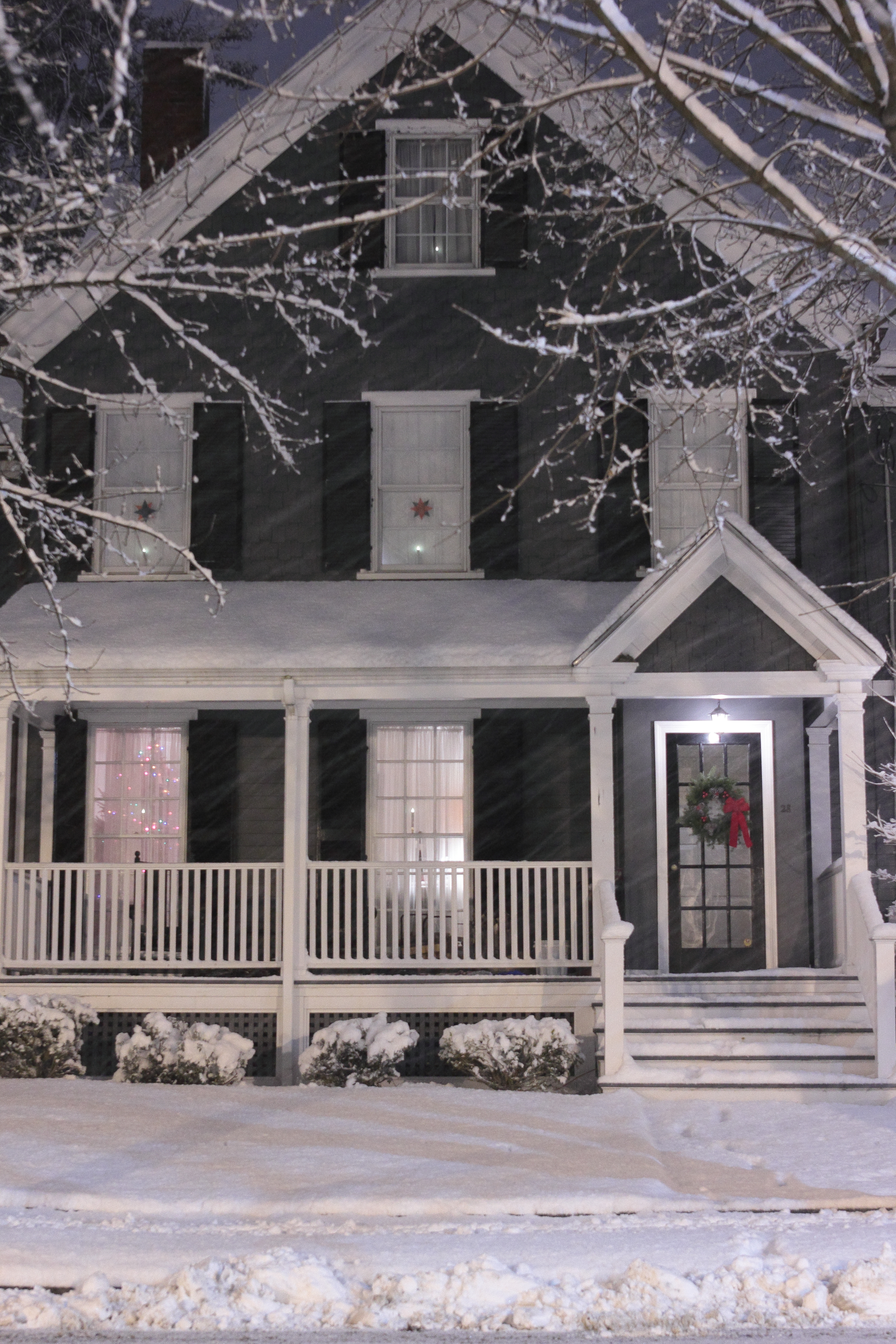
A cozy looking house on Maple Street during a snowstorm.
December 29, 2012.
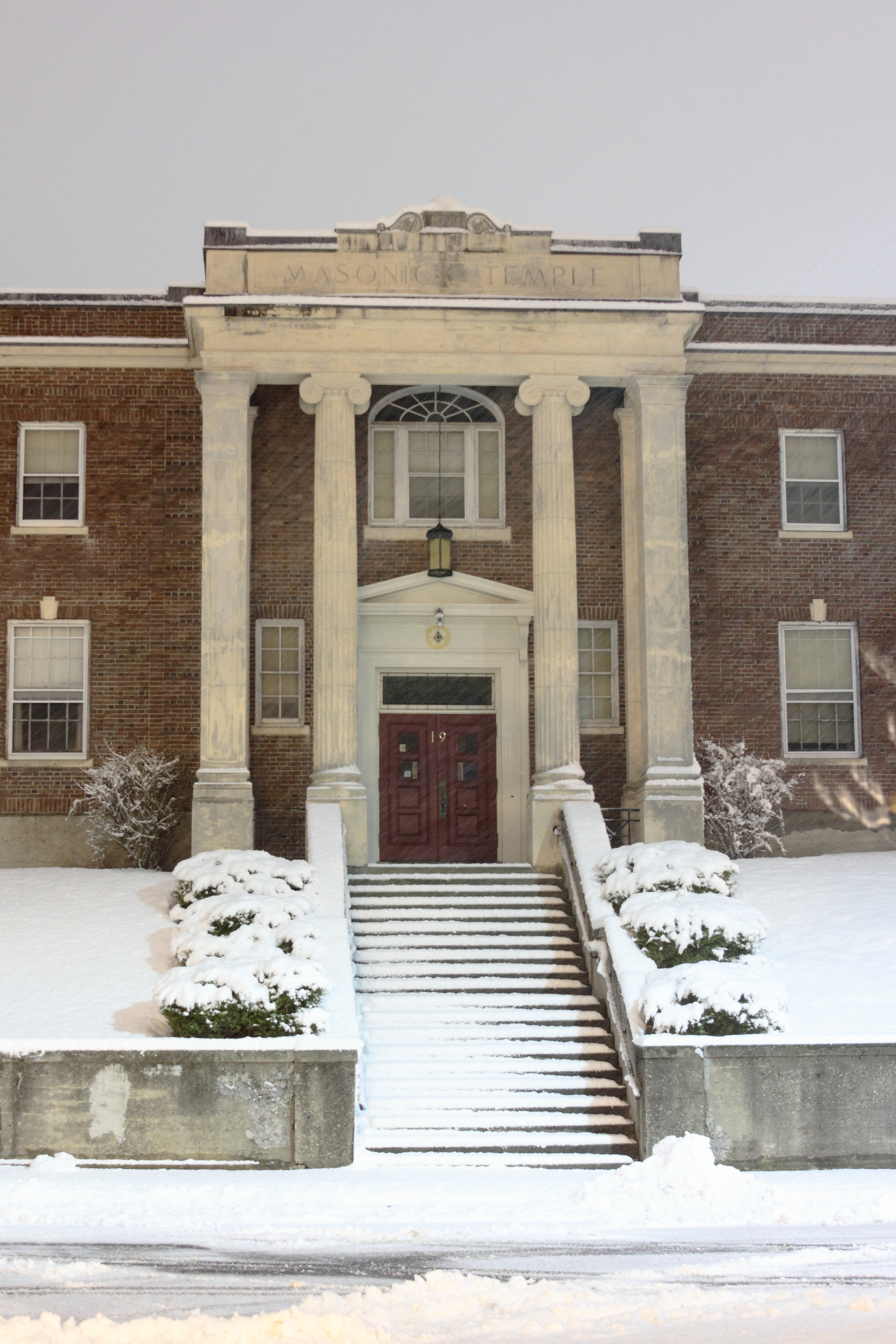
Snow blankets the grounds of the Masonic Temple on Academy Street.
December 29, 2012.

The wrought iron gate of the Maple Street library access trail during a snow storm.
December 29, 2012.

It’s a new year, be sure to visit the Robbins Library!
December 29, 2012.

The door to the tower of Trinity Baptist Church on Massachusetts Avenue in East Arlington.
June 21, 2012.

The front walkway and door of Bowes Pennell & Thompson Real Estate on Massachusetts Avenue.
July 31, 2012.

The entrance to DeVito Funeral Home on Massachusetts Avenue. August 31, 2012.

The front door of a Pleasant Street home. July 13, 2012.

The front entrance to the Kentwood apartment building on Massachusetts Avenue which was once home to Rock and Roll Hall of Fame inductee Herb Reed of The Platters. July 31, 2012.

The front door of the Arlington Rest Home on Lake Street. January 24, 2012.

The front door of the Church of Our Savior (Episcopal) on Marathon Street. September 19, 2011.
“Entryways” is a series documenting some of the doors, gates, openings, portals, entrances and exits of Arlington.

The front door of the First Baptist Church of Arlington. September 16, 2011.
“Entryways” is a series documenting some of the doors, gates, openings, portals, entrances and exits of Arlington.

The colorful entrance to the International School of Boston on Irving Street. May 29, 2011.
“Entryways” is a series documenting some of the doors, gates, openings, portals, entrances and exits of Arlington.

The Court Street Post Office with its restored front door on December 7, 2010.
On November 20, 2010, Entryways 12 showcased the front door of the Court Street Post Office which, at the time of the photograph, was being refurbished.
I have updated the map through 2011, so there are over 500 markers to explore all over the town of Arlington.
The RED markers indicate the daily photos, the YELLOW marks the locations of the stops on the popular WPA Walking Tour, the BLUE markers show the sites of the Entryways series, and the LIGHT BLUE represent Blue Oval buildings.
The map is based in Google Maps, so you can explore it with all the same features you are used to. (I suggest turning on the “hybrid” feature to see the satellite image of Arlington along with the roads et cetera.)
Just click below to take you to the full-size, interactive map.


The open foyer door of a Russell Street home on November 15, 2010.
“Entryways” is a series documenting some of the doors, gates, openings, portals, entrances and exits of Arlington.

The doorway to the Superintendent's Office inside the Court Street Post Office on November 15, 2010.
“Entryways” is a series documenting some of the doors, gates, openings, portals, entrances and exits of Arlington.

The doorway to the Court Street Post Office on November 15, 2010.
“Entryways” is a series documenting some of the doors, gates, openings, portals, entrances and exits of Arlington.

The Pleasant Street Congregational Church on November 5, 2010.
“Entryways” is a series documenting some of the doors, gates, openings, portals, entrances and exits of Arlington.

The former Arlington High School entrance on Academy Street. August 8, 2010.
“Entryways” is a series documenting some of the doors, gates, openings, portals, entrances and exits of Arlington.

An empty 75 Summer Street, past home of Mirak Auto Dealers and future home of Fresh Pond Seafood. July 22, 2010.
“Entryways” is a series documenting some of the doors, gates, openings, portals, entrances and exits of Arlington.

The Robbins Library entryway is modeled after the entryway of the Cancelleria Palace in Rome. August 13, 2010.
“Entryways” is a series documenting some of the doors, gates, openings, portals, entrances and exits of Arlington.

The Mystic Valley Lodge on Academy Street. August 9, 2010.
“Entryways” is a series documenting some of the doors, gates, openings, portals, entrances and exits of Arlington.

A gateway to a private residence on Hutchinson Road. July 21, 2010.
“Entryways” is a series documenting some of the doors, gates, openings, portals, entrances and exits of Arlington.

One of the exit/entrances of the octagonal Central Fire Station. July 22, 2010.
“Entryways” is a series documenting some of the doors, gates, openings, portals, entrances and exits of Arlington.

Documentation in the window of the empty 78 Bow Street, a space now occupied by Taylor Rental, on July 4, 2007.
“Entryways” is a series documenting some of the doors, gates, openings, portals, entrances and exits of Arlington.

A sign, showing the Stratton School's recent national recognition, over the playground doors on November 2, 2010.
“Entryways” is a series documenting some of the doors, gates, openings, portals, entrances and exits of Arlington.

The Edison building on Mystic Street. July 22, 2010.
“Entryways” is a series documenting some of the doors, gates, openings, portals, entrances and exits of Arlington.

“Entryways” is a series documenting some of the doors, gates, openings, portals, entrances and exits of Arlington.
